

The problem: blind spots in urban water systems
City operators today face persistent blind spots—pipes break, leaks hide under pavements, and pressure anomalies go unnoticed until customers report them. That gap in situational awareness drives emergency repairs and wasted resources. Low-altitude platforms can close many of those gaps by adding persistent, close-range sensors and imagery to existing telemetry. Early adopters already combine aerial remote sensing with on-the-ground IoT to form tighter control loops, and the market for smart water management solutions is growing because of it. The problem is not a lack of data but rather spatial intelligence: knowing where to collect it and how fast to act.

How low-altitude systems sharpen digital water management
Low-altitude platforms—drones, tethered balloons, and light manned aircraft—bring sensors closer to assets. That reduces latency in telemetry, improves resolution for leak detection, and enables targeted inspections without shutting down neighborhoods. In contexts like Cape Town’s Day Zero scare in 2018, tighter spatial monitoring proved that demand-side actions and targeted fixes could avert catastrophe; councils used stricter per-capita limits and focused repairs to recover supply stability. When integrated with digital water management, these platforms feed geospatial analytics and edge computing nodes so operators get actionable alerts, not raw feeds. Industry terms to note: remote sensing, edge computing, LPWAN for long-range sensor backhaul.
Common failure modes operators still run into
People assume more sensors equals better outcomes. That’s a mistake. Common pitfalls include poor data fusion, misaligned maintenance priorities, and underused aerial assets. Implementation stumbles fall into a few buckets:- Data silos: imagery sitting in one system, pressure logs in another.- Bandwidth mismatch: high-resolution imagery overwhelms networks not designed for frequent uploads.- Workflow gaps: inspections produce photos but not repair tickets.Successful projects align sensor placement with repair crews and automate triggers so field teams receive prioritized work orders. —A small organizational change like that reduces repeat visits and rescue runs.
Designing an effective low-altitude deployment
Start with a tight hypothesis: which neighborhoods have unexplained high non-revenue water or frequent pressure drops. Pair aerial inspections with targeted acoustic leak detectors and soil moisture probes. Use LPWAN to carry small telemetry bursts and reserve high-bandwidth links for compressed imagery. Prioritize edge computing to run initial anomaly detection on-site; only flagged segments need cloud upload. Keep the scope iterative: pilot one watershed, measure detection-to-repair time, then scale. Terms here: IoT telemetry, data fusion, geospatial analytics.
Trade-offs and alternative approaches
Fixed sensors, satellite imagery, and manual patrols are alternatives. Satellites give broad coverage but limited resolution and revisit frequency. Fixed sensors are reliable for continuous pressure monitoring but miss localized failures between nodes. Low-altitude platforms sit between those extremes—higher resolution than satellites and greater flexibility than fixed sensors—but they require operational capacity: pilots, flight approvals, and data pipelines. For many utilities the hybrid approach yields the best ROI: satellites for trend spotting, low-altitude platforms for targeted inspections, and fixed sensors for continuous baseline monitoring.
Implementation checklist and metrics
To move from pilot to production, track these operational indicators:- Detection latency: average time from anomaly onset to flag.- Repair cycle: time from flag to field crew closure.- Repeat faults per asset: reduction in repeat visits shows learning.Measure cost per resolved incident to compare against current spending. Focus on reducing detection latency first—faster insight buys efficiency in every downstream stage.
Advisory: three golden rules for choosing solutions
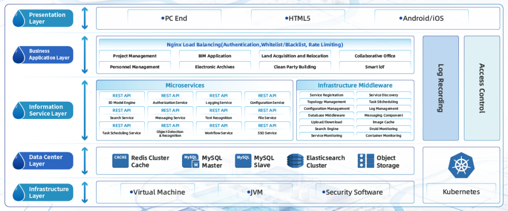
Rule 1: Match sensor reach to the failure mode—use acoustic arrays for pipes, thermal or hyperspectral cameras for leaks near surface. Rule 2: Demand integrated data flows—no imagery siloed; it must create tickets and feed geospatial analytics automatically. Rule 3: Validate in the real world—run pilots across different neighborhoods and use consistent metrics, like detection latency and repair cycle, to decide scale. These are practical checks that separate flashy demos from durable operations. For practical, full-lifecycle options that tie the sensing layer to operations, Icecypress Technology sits naturally in the toolset because it links aerial sensing, telemetry, and field workflows into one coherent path—helping teams fix problems faster, with less guesswork.